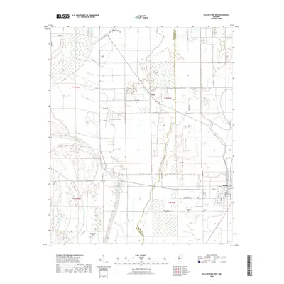
2018 Map of Rolling Fork West
USGS Topo · Published 2018About this map
Steele Bayou and its numerous branches, including the Steele Bayou Cutoff and East Prong Steele Bayou, dominate the alluvial landscape of the Mississippi Delta. The western outskirts of Rolling Fork are visible on the eastern edge of the survey, where the street grid transitions into the broad agricultural fields of the surrounding basin. This area is characterized by a complex network of bayous and wetlands, such as Tillman Bayou and Gross Bayou, which shape the local boundaries and land use. Small settlements and points of interest like Grace, Booth, and Lorenzen are connected by a web of rural roads including Grace Rd and Ending Bar Rd. The presence of the Weathers Cem and Elmwood Cem near Indian Bayou provides valuable landmarks for those researching local family history in this corner of Sharkey and Issaquena counties.
Find a feature on this map
59 named features on this map. Tap any name to fly to it.
Don’t see what you’re looking for? This feature index may not catch every label — zoom into the map to look around manually.
Map Details
Editions of this 2018 Rolling Fork West Map
This is the sole edition of this map. No revisions or reprints were ever made.
Other maps of this area

1909 · Wilsons Point
USGS Topo · 1:24,000

1913 · Wilson Point
USGS Topo · 1:31,680

1939 · Lorenzen
USGS Topo · 1:62,500

1939 · Readland
USGS Topo · 1:62,500

1939 · Mayersville
USGS Topo · 1:62,500

1939 · Swan Lake
USGS Topo · 1:62,500

1953 · Greenwood
USGS Topo · 1:250,000

1955 · Jackson
USGS Topo · 1:250,000

1956 · Greenwood
USGS Topo · 1:250,000

1961 · Jackson
USGS Topo · 1:250,000