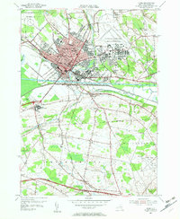
1955 Map of Rome
USGS Topo · Published 1957About this map
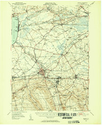
The city of Rome serves as the industrial and transportation hub of this mid-century survey, situated at the historic confluence of the Mohawk River and the Erie Canal. The landscape reflects a significant military and institutional presence, dominated by the sprawling Griffiss Air Force Base to the northeast and the large campus of the Rome State School to the west. Central to the town's identity is the site of Ft Stanwix, while educational institutions like Rome Free Academy and Laurel St Sch anchor the residential grid.
Find a feature on this map
47 named features on this map. Tap any name to fly to it.
Don’t see what you’re looking for? This feature index may not catch every label — zoom into the map to look around manually.
Map Details
Editions of this 1955 Rome Map
4 editions found
Other maps of this area

1895 · Oriskany
USGS Topo · 1:62,500

1895 · Oneida
USGS Topo · 1:62,500

1898 · Oneida
USGS Topo · 1:62,500

1898 · Oriskany
USGS Topo · 1:62,500

1902 · Oneida
USGS Topo · 1:62,500

1904 · Boonville
USGS Topo · 1:62,500

1905 · Taberg
USGS Topo · 1:62,500

1939 · Oneida
USGS Topo · 1:62,500

1943 · Lee Center
USGS Topo · 1:31,680
1946 · Oneida
USGS Topo · 1:62,500