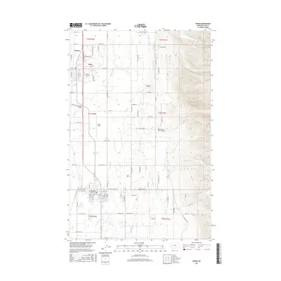
2017 Map of Ronan
USGS Topo · Published 2017About this map
Ronan serves as the focal point of this Mission Valley landscape, situated at a critical juncture where the flat agricultural plains meet the rising slopes of the Mission Range. The map reveals an intricate network of irrigation infrastructure essential to the region's farming economy, including the Pablo Feeder Canal and Ronan A Canal, which divert water from mountain-fed sources like North Crow Creek Canyon. This water management system, coupled with the straight-line grid of local roads such as Terrace Lake Rd E and Baptiste Rd, reflects the organized settlement patterns within the Flathead Reservation.
Find a feature on this map
79 named features on this map. Tap any name to fly to it.
Don’t see what you’re looking for? This feature index may not catch every label — zoom into the map to look around manually.
Map Details
Editions of this 2017 Ronan Map
This is the sole edition of this map. No revisions or reprints were ever made.
Other maps of this area

1920 · Flathead Lake
USGS Topo · 1:125,000

1921 · Elbow Lake
USGS Topo · 1:125,000

1955 · Choteau
USGS Topo · 1:250,000

1956 · Wallace
USGS Topo · 1:250,000

1957 · Choteau
USGS Topo · 1:250,000

1958 · Choteau
USGS Topo · 1:250,000

1960 · Wallace
USGS Topo · 1:250,000

1962 · Choteau
USGS Topo · 1:250,000

1964 · East Bay
USGS Topo · 1:24,000

1964 · Fort Connah
USGS Topo · 1:24,000