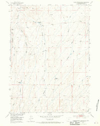
1952 Map of Rongis Reservoir SE
USGS Topo · Published 1970About this map
The Muskrat Oil Field defines the northern reaches of this Wyoming landscape, where early energy exploration is marked by scattered Gas Well and Oil Well sites. The terrain is a complex network of ephemeral watercourses, primarily the various branches of Horseshoe Draw, including the Middle Fork and West Fork. These drainages are interspersed with vital ranching water sources such as Sherlock Reservoir and Barber Reservoir.
Find a feature on this map
17 named features on this map. Tap any name to fly to it.
Don’t see what you’re looking for? This feature index may not catch every label — zoom into the map to look around manually.
Map Details
Editions of this 1952 Rongis Reservoir SE Map
4 editions found
Other maps of this area

1952 · Tin Cup Mountain
USGS Topo · 1:24,000

1952 · Muskrat Basin
USGS Topo · 1:24,000

1952 · Rongis Reservoir SE
USGS Topo · 1:24,000

1952 · Double Butte
USGS Topo · 1:24,000

1952 · Love Ranch
USGS Topo · 1:24,000

1952 · Rongis Reservoir
USGS Topo · 1:24,000

1952 · Puddle Springs
USGS Topo · 1:24,000

1952 · Butte Well
USGS Topo · 1:24,000

1952 · Coyote Springs
USGS Topo · 1:24,000

1955 · Casper
USGS Topo · 1:250,000