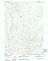
1952 Map of Rongis Reservoir SE
USGS Topo · Published 1985About this map
Industrial activity in the high desert of Fremont County is centered around the Muskrat Oil Field, where numerous oil and gas wells dot the landscape. The terrain is defined by a complex network of ephemeral drainages, including the various forks of Horseshoe Creek and substantial features like Mahoney Draw and Murphy Draw. Water management for the region’s ranching or industrial needs is evidenced by the presence of the Barber Reservoir and Sherlock Reservoir.
Find a feature on this map
19 named features on this map. Tap any name to fly to it.
Don’t see what you’re looking for? This feature index may not catch every label — zoom into the map to look around manually.
Map Details
Editions of this 1952 Rongis Reservoir SE Map
4 editions found
Other maps of this area

1952 · Tin Cup Mountain
USGS Topo · 1:24,000

1952 · Muskrat Basin
USGS Topo · 1:24,000

1952 · Rongis Reservoir SE
USGS Topo · 1:24,000

1952 · Double Butte
USGS Topo · 1:24,000

1952 · Love Ranch
USGS Topo · 1:24,000

1952 · Rongis Reservoir
USGS Topo · 1:24,000

1952 · Puddle Springs
USGS Topo · 1:24,000

1952 · Butte Well
USGS Topo · 1:24,000

1952 · Coyote Springs
USGS Topo · 1:24,000

1955 · Casper
USGS Topo · 1:250,000