
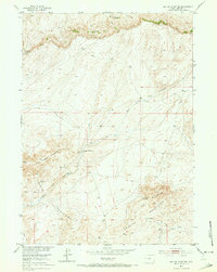
1952 Map of Tin Cup Mountain
USGS Topo · Published 1953About this map
Beaver Rim dominates the northern horizon of this mid-century survey, marking a significant topographical break in the high plains of Fremont County. The landscape is defined by the convergence of the Granite Mountains and Long Creek Mountain, where high-altitude water sources like Findlay Springs and Tin Cup Spring were critical for sustaining early settlement. Evidence of rural life and natural resource extraction is anchored by the Givens Homestead and the Long Creek Ranch, while the Tin Cup Mine (Inactive) near the base of Tin Cup Mountain indicates the area's geological and prospecting interests. This 1952 study provides a clear view of the water management infrastructure of the era, including the Findlay Reservoir and its associated Ditch, as it appeared before modern development altered the drainage patterns of Long Creek and Tin Cup Creek.
Find a feature on this map
16 named features on this map. Tap any name to fly to it.
Don’t see what you’re looking for? This feature index may not catch every label — zoom into the map to look around manually.
Map Details
Editions of this 1952 Tin Cup Mountain Map
3 editions found
Other maps of this area

1951 · Stampede Meadow
USGS Topo · 1:24,000

1951 · Graham Ranch
USGS Topo · 1:24,000

1951 · Myers Ranch
USGS Topo · 1:24,000

1952 · Muskrat Basin
USGS Topo · 1:24,000

1952 · Rongis Reservoir SE
USGS Topo · 1:24,000

1952 · Rongis Reservoir
USGS Topo · 1:24,000

1953 · Blue Gulch
USGS Topo · 1:24,000

1953 · Elkhorn Springs
USGS Topo · 1:24,000

1955 · Lander
USGS Topo · 1:250,000

1955 · Casper
USGS Topo · 1:250,000