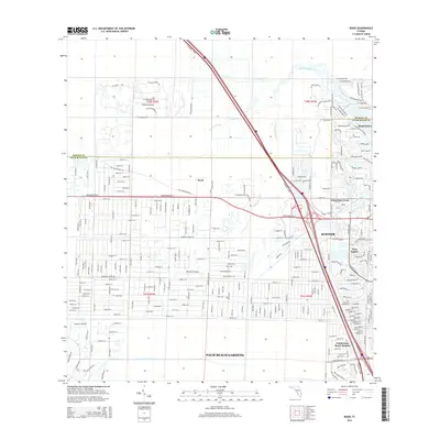
2015 Map of Rood
USGS Topo · Published 2015About this map
Jupiter and Tequesta sit at the confluence of the Loxahatchee River and its various tributaries, anchoring a landscape where coastal developments meet inland wetlands and aviation strips. This 2015 survey illustrates the dense residential network of West Jupiter and North Palm Beach Heights alongside the managed hydrology of the Hungryland Slough Canal and Cypress Creek. The map details the transition from the structured street grids of Palm Beach Gardens to the more specialized communities near Tailwinds Airport and the BR Ranch Airport. The path of Florida's Tpke bisects the region, providing a modern transit corridor through what remains a water-rich environment defined by the winding course of the Southwest Fork Loxahatchee River and the rural pocket of Rood. The presence of Limestone Creek further highlights the area's intricate drainage and settlement patterns.
Find a feature on this map
257 named features on this map. Tap any name to fly to it.
Don’t see what you’re looking for? This feature index may not catch every label — zoom into the map to look around manually.
Map Details
Editions of this 2015 Rood Map
This is the sole edition of this map. No revisions or reprints were ever made.
Other maps of this area

1945 · Delta
USGS Topo · 1:24,000

1946 · Riviera Beach
USGS Topo · 1:24,000

1948 · Rood
USGS Topo · 1:24,000

1948 · Gomez
USGS Topo · 1:24,000

1948 · Hobe Sound
USGS Topo · 1:24,000

1948 · Jupiter
USGS Topo · 1:24,000

1949 · Rood
USGS Topo · 1:24,000

1949 · Gomez
USGS Topo · 1:24,000

1949 · Riviera Beach
USGS Topo · 1:24,000

1949 · Hobe Sound
USGS Topo · 1:24,000