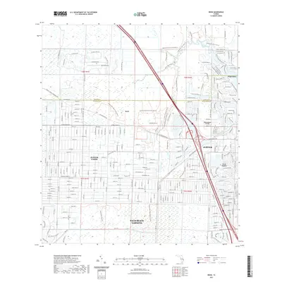
2021 Map of Rood
USGS Topo · Published 2021About this map
Cypress Creek and the Loxahatchee River system define the drainage and settlement patterns of this coastal Florida landscape near the border of Martin and Palm Beach counties. The area exhibits a distinct shift from the dense residential developments of Tequesta, Jupiter, and Limestone Creek in the east to the more rural, grid-patterned acreage of Jupiter Farms further west. This transition is bridged by an extensive network of recreational paths, including the Ocean To Lake Hiking Trl and the Loxahatchee River State Trl, which navigate the preserved wetlands of Jonathan Dickinson State Park and the Loxahatchee Slough Natural Area. The presence of the Hungryland Slough Canal and the Tailwinds Airport underscores the ongoing engineering and infrastructure required to manage the low-lying terrain for both transport and habitation at the edge of the Atlantic coast.
Find a feature on this map
32 named features on this map. Tap any name to fly to it.
Don’t see what you’re looking for? This feature index may not catch every label — zoom into the map to look around manually.
Map Details
Editions of this 2021 Rood Map
This is the sole edition of this map. No revisions or reprints were ever made.
Other maps of this area

1945 · Delta
USGS Topo · 1:24,000

1946 · Riviera Beach
USGS Topo · 1:24,000

1948 · Rood
USGS Topo · 1:24,000

1948 · Gomez
USGS Topo · 1:24,000

1948 · Hobe Sound
USGS Topo · 1:24,000

1948 · Jupiter
USGS Topo · 1:24,000

1949 · Rood
USGS Topo · 1:24,000

1949 · Gomez
USGS Topo · 1:24,000

1949 · Riviera Beach
USGS Topo · 1:24,000

1949 · Hobe Sound
USGS Topo · 1:24,000