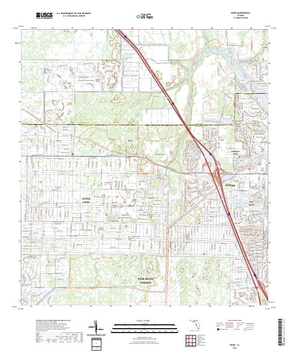
2024 Map of Rood
USGS Topo · Published 2024About this map
Jupiter Farms and the surrounding reaches of the Loxahatchee River dominate this modern survey of northern Palm Beach County. The landscape is characterized by a dense network of residential streets and trails that interface with significant conservation lands, including the Loxahatchee Slough Natural Area and the Cypress Creek Natural Area. These protected spaces preserve the hydrologic character of the Hungryland Slough Canal and Kitching Creek as they flow toward the Atlantic coast.
Find a feature on this map
63 named features on this map. Tap any name to fly to it.
Don’t see what you’re looking for? This feature index may not catch every label — zoom into the map to look around manually.
Map Details
Editions of this 2024 Rood Map
This is the sole edition of this map. No revisions or reprints were ever made.
Other maps of this area

1945 · Delta
USGS Topo · 1:24,000

1946 · Riviera Beach
USGS Topo · 1:24,000

1948 · Rood
USGS Topo · 1:24,000

1948 · Gomez
USGS Topo · 1:24,000

1948 · Hobe Sound
USGS Topo · 1:24,000

1948 · Jupiter
USGS Topo · 1:24,000

1949 · Rood
USGS Topo · 1:24,000

1949 · Gomez
USGS Topo · 1:24,000

1949 · Riviera Beach
USGS Topo · 1:24,000

1949 · Hobe Sound
USGS Topo · 1:24,000