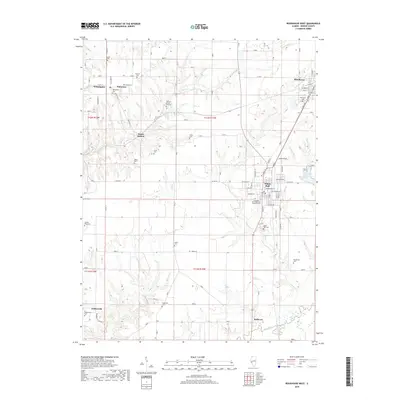
2018 Map of Roodhouse West
USGS Topo · Published 2018About this map
White Hall and Roodhouse anchor this Greene County landscape, where the agricultural grid meets the winding courses of Hurricane Cr and Apple Cr. The region is marked by a dense concentration of historical burial sites, ranging from the large Fernwood Cem to smaller family-named locations like the William Wood Cem and Rawlins Cem. These markers of early settlement are scattered among small communities such as Wilmington, Patterson, and Walkerville.
Find a feature on this map
53 named features on this map. Tap any name to fly to it.
Don’t see what you’re looking for? This feature index may not catch every label — zoom into the map to look around manually.
Map Details
Editions of this 2018 Roodhouse West Map
This is the sole edition of this map. No revisions or reprints were ever made.
Other maps of this area

1924 · Winchester
USGS Topo · 1:48,000

1924 · Roodhouse
USGS Topo · 1:62,500

1924 · Griggsville
USGS Topo · 1:62,500

1926 · Griggsville
USGS Topo · 1:62,500

1926 · Winchester
USGS Topo · 1:62,500

1926 · Roodhouse
USGS Topo · 1:62,500

1930 · Pearl
USGS Topo · 1:62,500

1948 · Quincy
USGS Topo · 1:250,000

1950 · Pearl
USGS Topo · 1:62,500

1956 · Quincy
USGS Topo · 1:250,000