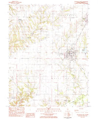
1983 Map of Roodhouse West
USGS Topo · Published 1984About this map
White Hall and the surrounding township of Roodhouse form the industrial and civic heart of this Greene County landscape. The Illinois Central Gulf railroad serves as the primary artery for the region, connecting the larger settlements with smaller outposts like Hanks Station and West Roodhouse. The map reveals a high density of rural burial grounds, including the Rawlins Cem, Pine Tree Cem, and Johnson Cem, which often cluster near early creek-side settlements. Along the southern edge, Apple Creek and Whitaker Creek wind through the terrain near Belltown. This survey captures the transition from small-town centers to the intensive agricultural and rail-oriented economy of the early 1980s, documenting local landmarks such as the White Hall Hosp and the North Green High Sch.
Find a feature on this map
48 named features on this map. Tap any name to fly to it.
Don’t see what you’re looking for? This feature index may not catch every label — zoom into the map to look around manually.
Map Details
Editions of this 1983 Roodhouse West Map
This is the sole edition of this map. No revisions or reprints were ever made.
Other maps of this area

1924 · Winchester
USGS Topo · 1:48,000

1924 · Roodhouse
USGS Topo · 1:62,500

1924 · Griggsville
USGS Topo · 1:62,500

1926 · Griggsville
USGS Topo · 1:62,500

1926 · Winchester
USGS Topo · 1:62,500

1926 · Roodhouse
USGS Topo · 1:62,500

1930 · Pearl
USGS Topo · 1:62,500

1948 · Quincy
USGS Topo · 1:250,000

1950 · Pearl
USGS Topo · 1:62,500

1956 · Quincy
USGS Topo · 1:250,000