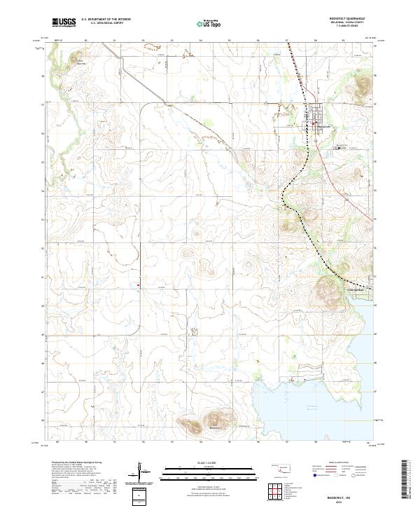
2022 Map of Roosevelt
USGS Topo · Published 2022About this map
The town of Roosevelt serves as the primary hub of this Kiowa County landscape, positioned at the junction of Highway 183 and several local routes including W Tiffany St and S Main St. To the south lies the settlement of Cold Springs, situated along the eastern banks of the expansive Tom Steed Reservoir. This 2022 survey captures a transition from the structured residential grid of Roosevelt, which includes the Roosevelt Cem, to the surrounding agricultural township and range divisions defined by roads like E1500 Rd.
Find a feature on this map
44 named features on this map. Tap any name to fly to it.
Don’t see what you’re looking for? This feature index may not catch every label — zoom into the map to look around manually.
Map Details
Editions of this 2022 Roosevelt Map
This is the sole edition of this map. No revisions or reprints were ever made.
Other maps of this area

1949 · Cooperton
USGS Topo · 1:62,500

1950 · Snyder
USGS Topo · 1:62,500

1955 · Lawton
USGS Topo · 1:250,000

1956 · Glen Mountains
USGS Topo · 1:24,000

1956 · Snyder
USGS Topo · 1:24,000

1956 · Rainy Mountain Creek
USGS Topo · 1:24,000

1956 · Snyder
USGS Topo · 1:62,500

1956 · Cooperton
USGS Topo · 1:62,500

1963 · Babbs
USGS Topo · 1:24,000

1964 · Lone Wolf
USGS Topo · 1:24,000