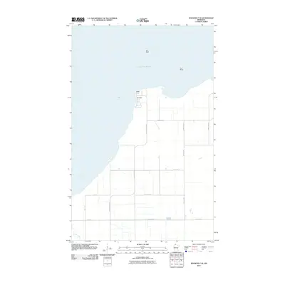
2010 Map of Roosevelt NE
USGS Topo · Published 2010About this map
Arnesen sits along the southern shoreline of Lake of the Woods in this 2010 survey of Minnesota’s northern reaches. The landscape is defined by the sharp transition between the vast inland sea and the low-lying coastal plain, marked by distinctive geological features like Rocky Point, Gull Rock, and Twin Rocks. The interior is organized by a rigid grid of rural roads, including Rocky Point Rd NW and County Hwy-9, which serve the local agricultural and residential holdings. In the southernmost portion of the map, Willow Creek meanders toward the lake, providing a natural break in the engineered roadway network. This map documents the persistent settlement patterns and coastal access points in a region where the water of the lake dictates the local economy and geography.
Find a feature on this map
17 named features on this map. Tap any name to fly to it.
Don’t see what you’re looking for? This feature index may not catch every label — zoom into the map to look around manually.
Map Details
Editions of this 2010 Roosevelt NE Map
This is the sole edition of this map. No revisions or reprints were ever made.
Other maps of this area

1918 · Buffalo Bay
USGS Topo · 1:62,500

1918 · Roosevelt
USGS Topo · 1:62,500

1918 · Williams
USGS Topo · 1:62,500

1943 · Roosevelt
USGS Topo · 1:62,500

1954 · Roseau
USGS Topo · 1:250,000

1957 · Roseau
USGS Topo · 1:250,000

1958 · Roseau
USGS Topo · 1:250,000

1963 · Kenora
USGS Topo · 1:250,000

1967 · Williams
USGS Topo · 1:24,000

1967 · Roosevelt NW
USGS Topo · 1:24,000