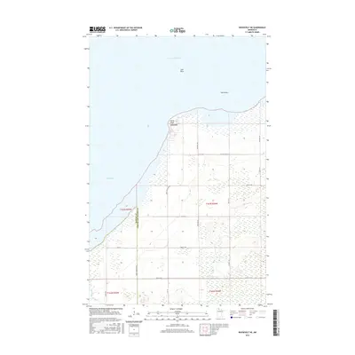
2016 Map of Roosevelt NE
USGS Topo · Published 2016About this map
Arnesén serves as the primary gateway to the vast waters of Lake of the Woods on this northern Minnesota landscape. Situated on the edge of Muskeg Bay, the settlement is defined by its proximity to the rocky shoreline and the transition from land to water at Rocky Point. The map details a network of rural roads such as Co HWY 9 and 64th ST NW that cut through the low-lying terrain, connecting isolated homesteads and local infrastructure. Offshore, the hazardous waters are marked by landmarks like Gull Rock and Twin Rocks, providing vital navigation points for those on the lake. The survey also precisely delineates the boundary between Roseau Co and Lake of the Woods Co, reflecting the administrative divisions of this remote border region.
Find a feature on this map
27 named features on this map. Tap any name to fly to it.
Don’t see what you’re looking for? This feature index may not catch every label — zoom into the map to look around manually.
Map Details
Editions of this 2016 Roosevelt NE Map
This is the sole edition of this map. No revisions or reprints were ever made.
Other maps of this area

1918 · Buffalo Bay
USGS Topo · 1:62,500

1918 · Roosevelt
USGS Topo · 1:62,500

1918 · Williams
USGS Topo · 1:62,500

1943 · Roosevelt
USGS Topo · 1:62,500

1954 · Roseau
USGS Topo · 1:250,000

1957 · Roseau
USGS Topo · 1:250,000

1958 · Roseau
USGS Topo · 1:250,000

1963 · Kenora
USGS Topo · 1:250,000

1967 · Williams
USGS Topo · 1:24,000

1967 · Roosevelt NW
USGS Topo · 1:24,000