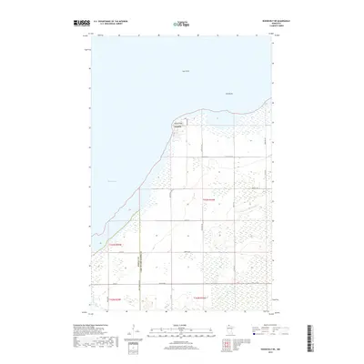
2019 Map of Roosevelt NE
USGS Topo · Published 2019About this map
Arnesén sits along the southwestern reaches of Lake of the Woods, positioned near the prominent landform of Rocky Point. This lakefront landscape is defined by the expanse of Muskeg Bay and the presence of offshore landmarks such as Gull Rock and Twin Rocks. The area's geography is characterized by low-lying wetlands and drainage features like Willow Cr, which transitions from the interior toward the Great Lake. The road network, including Cty 356 and Co Hwy 10, reflects a rural settlement pattern focused on the shoreline and the section-line grids typical of northern Minnesota. This map captures the intersection of the Roseau and Lake of the Woods county line, illustrating the administrative and physical boundaries of this remote coastal region.
Find a feature on this map
28 named features on this map. Tap any name to fly to it.
Don’t see what you’re looking for? This feature index may not catch every label — zoom into the map to look around manually.
Map Details
Editions of this 2019 Roosevelt NE Map
This is the sole edition of this map. No revisions or reprints were ever made.
Other maps of this area

1918 · Buffalo Bay
USGS Topo · 1:62,500

1918 · Roosevelt
USGS Topo · 1:62,500

1918 · Williams
USGS Topo · 1:62,500

1943 · Roosevelt
USGS Topo · 1:62,500

1954 · Roseau
USGS Topo · 1:250,000

1957 · Roseau
USGS Topo · 1:250,000

1958 · Roseau
USGS Topo · 1:250,000

1963 · Kenora
USGS Topo · 1:250,000

1967 · Williams
USGS Topo · 1:24,000

1967 · Roosevelt NW
USGS Topo · 1:24,000