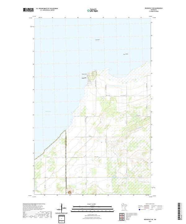
2022 Map of Roosevelt NE
USGS Topo · Published 2022About this map
Arnesén sits along the southern shores of Lake of the Woods, marking a distinct point of human settlement in this watery borderland. The landscape is defined by the transition from the marshy expanse of Muskeg Bay to the solid ground of Rocky Point, where a network of local roads like Rocky Point Rd NW and Co Hwy 10 connect the lakeside community. This 2022 survey captures the modern geography of the Roseau Co Lake of the Woods Co boundary, showing how the grid of section lines and county roads persists across the low-lying terrain.
Find a feature on this map
23 named features on this map. Tap any name to fly to it.
Don’t see what you’re looking for? This feature index may not catch every label — zoom into the map to look around manually.
Map Details
Editions of this 2022 Roosevelt NE Map
This is the sole edition of this map. No revisions or reprints were ever made.
Other maps of this area

1918 · Buffalo Bay
USGS Topo · 1:62,500

1918 · Roosevelt
USGS Topo · 1:62,500

1918 · Williams
USGS Topo · 1:62,500

1943 · Roosevelt
USGS Topo · 1:62,500

1954 · Roseau
USGS Topo · 1:250,000

1957 · Roseau
USGS Topo · 1:250,000

1958 · Roseau
USGS Topo · 1:250,000

1963 · Kenora
USGS Topo · 1:250,000

1967 · Williams
USGS Topo · 1:24,000

1967 · Roosevelt NW
USGS Topo · 1:24,000