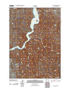
2011 Map of Rooster Comb
USGS Topo · Published 2011About this map
Lake Owyhee dominates this landscape in Malheur County, its winding waters carving a deep path between distinctive geological formations. This 2011 survey illustrates a remote area characterized by dramatic elevation changes, from the heights of Mahogany Mountain and North Table Mountain to the shores of the reservoir. Remote outposts and seasonal camps are the primary signs of human presence, with Leslie Gulch Camp and Spring Creek Camp providing access points for those traversing this high-desert environment.
Find a feature on this map
28 named features on this map. Tap any name to fly to it.
Don’t see what you’re looking for? This feature index may not catch every label — zoom into the map to look around manually.
Map Details
Editions of this 2011 Rooster Comb Map
This is the sole edition of this map. No revisions or reprints were ever made.
Other maps of this area

1955 · Boise
USGS Topo · 1:250,000

1958 · Boise
USGS Topo · 1:250,000

1962 · Boise
USGS Topo · 1:250,000

1967 · Pelican Point
USGS Topo · 1:24,000

1967 · Diamond Butte
USGS Topo · 1:24,000
1967 · Bannock Ridge
USGS Topo · 1:24,000

1967 · Rooster Comb
USGS Topo · 1:24,000

1967 · Quartz Mtn Basin
USGS Topo · 1:24,000
1967 · Three Fingers Rock
USGS Topo · 1:24,000
1969 · Mahogany Gap
USGS Topo · 1:24,000