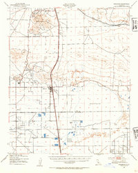
1943 Map of Rosamond
USGS Topo · Published 1954About this map
Soledad Mountain dominates the northwestern portion of this 1943 survey, serving as a hub for local mining activity during the mid-twentieth century. The slopes are marked with notable excavations including the Golden Queen Mine, Double Eagle Mine, and Tropico Mine, reflecting the area's rich mineral history. The landscape transitions from these peaks into the high desert plains where Rosamond sits at the junction of the Southern Pacific railroad and the Mojave Road.
Find a feature on this map
29 named features on this map. Tap any name to fly to it.
Don’t see what you’re looking for? This feature index may not catch every label — zoom into the map to look around manually.
Map Details
Editions of this 1943 Rosamond Map
2 editions found

Other maps of this area

1915 · Elizabeth Lake
USGS Topo · 1:125,000

1915 · Searles Lake
USGS Topo · 1:250,000

1915 · Mojave
USGS Topo · 1:125,000

1917 · Elizabeth Lake
USGS Topo · 1:125,000

1930 · Oban
USGS Topo · 1:24,000

1930 · Roosevelt School
USGS Topo · 1:24,000

1930 · Casa Desierta
USGS Topo · 1:24,000

1931 · Esperanza School
USGS Topo · 1:24,000

1933 · Casa Desierta
USGS Topo · 1:24,000

1933 · Roosevelt School
USGS Topo · 1:24,000