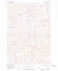
1956 Map of Roscoe NE
USGS Topo · Published 1977About this map
The boundary between Stillwater County and Carbon County cuts through this mid-century cattle-and-crop landscape, where family operations dominate the high plains. Named homesteads like the Walter Korpela Ranch and Maki Ranch are connected by a network of unimproved roads and irrigation infrastructure. The agricultural character of the era is evidenced by the density of managed water features, including the Ramsland Ditch, Abar Ditch, and Canal S, which diverted flow from natural drainages like West Fork Rock Creek and Lodge Red Creek.
Find a feature on this map
25 named features on this map. Tap any name to fly to it.
Don’t see what you’re looking for? This feature index may not catch every label — zoom into the map to look around manually.
Map Details
Editions of this 1956 Roscoe NE Map
3 editions found
Other maps of this area

1892 · Stillwater
USGS Topo · 1:125,000

1932 · Red Lodge No 2
USGS Topo · 1:48,000

1932 · Red Lodge No 1
USGS Topo · 1:48,000

1954 · Billings
USGS Topo · 1:250,000

1955 · Whitebird School
USGS Topo · 1:24,000

1955 · Absarokee
USGS Topo · 1:24,000

1956 · Roscoe
USGS Topo · 1:24,000

1956 · Shane Ridge
USGS Topo · 1:24,000

1956 · Roscoe NW
USGS Topo · 1:24,000

1956 · Roscoe NE
USGS Topo · 1:24,000