
1950 Map of Roscommon North
USGS Topo · Published 1978About this map
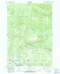
The South Branch Au Sable River meanders through a landscape transitioning between timber and recreational use at the mid-century. While Roscommon serves as the primary hub along the New York Central railroad, much of the surrounding territory is governed by the Huron National Forest and Higgins Lake State Forest. This era in Crawford and Roscommon Counties is marked by a clear turn toward conservation and outdoorsmanship, evidenced by the Bay City Hunting and Fishing Club and several lodges like Bell Top Lodge. Traces of the region's industrial past and present appear at the Northern Block and Supply Company and scattered Sawmill sites. Locally significant landmarks such as Chase Bridge and the Pioneer Cemetery provide grounding for genealogists tracing families in the area before more modern developments altered these woods.
Find a feature on this map
21 named features on this map. Tap any name to fly to it.
Don’t see what you’re looking for? This feature index may not catch every label — zoom into the map to look around manually.
Map Details
Editions of this 1950 Roscommon North Map
2 editions found
Other maps of this area

1949 · Grayling
USGS Topo · 1:62,500

1950 · Grayling
USGS Topo · 1:24,000

1951 · Wakeley Lake
USGS Topo · 1:24,000

1951 · Grayling
USGS Topo · 1:24,000

1951 · Roscommon North
USGS Topo · 1:24,000

1951 · Pere Cheney
USGS Topo · 1:24,000

1954 · Traverse City
USGS Topo · 1:250,000

1958 · Traverse City
USGS Topo · 1:250,000

1963 · Roscommon South
USGS Topo · 1:24,000

1963 · Eldorado
USGS Topo · 1:24,000
Featured Places
- Roscommon, Higgins Township
- Higgins Township, MI
- Deerheart Valley, South Branch Township
- Beaver Creek Township, MI
- Gerrish Township, MI