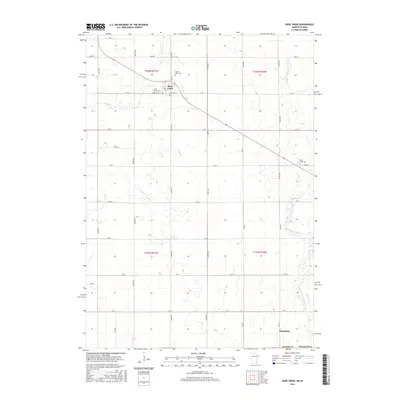
2016 Map of Rose Creek
USGS Topo · Published 2016About this map
Rose Creek sits at the northern edge of this Mower County landscape, serving as a focal point for the surrounding agricultural sections in the years following the millennium. The town is flanked by historic burial grounds including Saint Peter Cem and Prairie View Cem, while the hamlet of Johnsburg anchors the southern reaches near the state line. The terrain is defined by a dendritic drainage pattern where Rose Cr and Otter Cr feed the larger basin, and the Little Cedar River winds through the eastern townships. A rigid grid of rural routes, such as 640th Ave and 110 St, partitions the land into the traditional Public Land Survey System squares of t102n r17w and t101n r16w, reflecting the long-standing organizational structure of Minnesota's prairie borderlands.
Find a feature on this map
36 named features on this map. Tap any name to fly to it.
Don’t see what you’re looking for? This feature index may not catch every label — zoom into the map to look around manually.
Map Details
Editions of this 2016 Rose Creek Map
This is the sole edition of this map. No revisions or reprints were ever made.
Other maps of this area

1954 · Austin
USGS Topo · 1:62,500

1954 · Mason City
USGS Topo · 1:250,000

1957 · Mason City
USGS Topo · 1:250,000

1958 · Mason City
USGS Topo · 1:250,000

1965 · Dexter
USGS Topo · 1:24,000

1965 · Adams
USGS Topo · 1:24,000

1972 · St. Ansgar
USGS Topo · 1:24,000

1972 · Little Cedar
USGS Topo · 1:24,000
1972 · Stacyville
USGS Topo · 1:24,000
1982 · Austin East
USGS Topo · 1:24,000