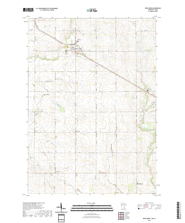
2022 Map of Rose Creek
USGS Topo · Published 2022About this map
Rose Creek serves as a focal point of this agricultural landscape in Mower County, where the settlement’s layout is framed by the diagonal passage of the Shooting Star State Trl. This trail, following a former rail corridor, cuts across the township divisions of t102n r17w and t102n r16w, linking the community to the surrounding farmland. The area is defined by its watercourses, including the Little Cedar River and Otter Cr, which meander through a grid of section roads like 170 ST and 610th Ave. Genealogists will find significant local history in the presence of Saint Peter Cem and Prairie View Cem near the town center, while the southern settlement of Johnsburg sits just above the Mower Co State Line St. The map illustrates a stable rural geography where family-named roads and cemeteries mark the legacy of the region's farming heritage.
Find a feature on this map
38 named features on this map. Tap any name to fly to it.
Don’t see what you’re looking for? This feature index may not catch every label — zoom into the map to look around manually.
Map Details
Editions of this 2022 Rose Creek Map
This is the sole edition of this map. No revisions or reprints were ever made.
Other maps of this area

1954 · Austin
USGS Topo · 1:62,500

1954 · Mason City
USGS Topo · 1:250,000

1957 · Mason City
USGS Topo · 1:250,000

1958 · Mason City
USGS Topo · 1:250,000

1965 · Dexter
USGS Topo · 1:24,000

1965 · Adams
USGS Topo · 1:24,000

1972 · St. Ansgar
USGS Topo · 1:24,000

1972 · Little Cedar
USGS Topo · 1:24,000
1972 · Stacyville
USGS Topo · 1:24,000
1982 · Austin East
USGS Topo · 1:24,000