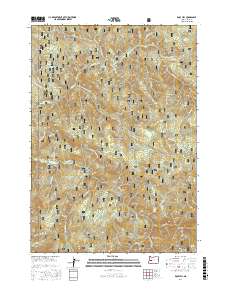
2017 Map of Rose Hill
USGS Topo · Published 2017About this map
The Umpqua National Forest defines the character of this 2017 survey, revealing a landscape etched by significant watercourses and sharp topographical rises. High-elevation points like Rose Hill, Sugarloaf Mtn, and Noonday Ridge create a dramatic vertical profile, while the hydrological network includes Brice Cr and Layng Cr. Of particular interest to those studying the region's natural landmarks are the named cascades, such as Spirit Falls, Lower Frestle Creek Falls, and Upper Frestle Creek Falls, which suggest the steep gradients found throughout the quadrangle.
Find a feature on this map
47 named features on this map. Tap any name to fly to it.
Don’t see what you’re looking for? This feature index may not catch every label — zoom into the map to look around manually.
Map Details
Editions of this 2017 Rose Hill Map
This is the sole edition of this map. No revisions or reprints were ever made.
Other maps of this area

1935 · Lowell
USGS Topo · 1:96,000

1942 · Lowell
USGS Topo · 1:125,000

1955 · Hardesty Mtn
USGS Topo · 1:62,500

1955 · Fairview Peak
USGS Topo · 1:62,500

1955 · Culp Creek
USGS Topo · 1:62,500

1955 · Lowell
USGS Topo · 1:62,500

1958 · Roseburg
USGS Topo · 1:250,000

1959 · Roseburg
USGS Topo · 1:250,000

1983 · Oakridge
USGS Topo · 1:100,000
1986 · Mount June
USGS Topo · 1:24,000