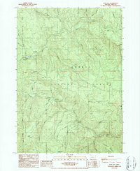
1986 Map of Rose Hill
USGS Topo · Published 1986About this map
The Willamette National Forest and Umpqua National Forest converge in this high-elevation landscape, where the administrative boundary divides the rugged drainages of the Calapooya Mountains. The map highlights a long history of resource management and recreation, anchored by the Layng Creek Work Center and specialized sites like the Layng Creek Fossil Beds. Small settlements and seasonal outposts such as Lund Park and Hobo Camp are situated along Brice Creek, reflecting the area's legacy of mining and forestry camps that once peppered these steep ridges.
Find a feature on this map
42 named features on this map. Tap any name to fly to it.
Don’t see what you’re looking for? This feature index may not catch every label — zoom into the map to look around manually.
Map Details
Editions of this 1986 Rose Hill Map
This is the sole edition of this map. No revisions or reprints were ever made.
Other maps of this area

1935 · Lowell
USGS Topo · 1:96,000

1942 · Lowell
USGS Topo · 1:125,000

1955 · Hardesty Mtn
USGS Topo · 1:62,500

1955 · Fairview Peak
USGS Topo · 1:62,500

1955 · Culp Creek
USGS Topo · 1:62,500

1955 · Lowell
USGS Topo · 1:62,500

1958 · Roseburg
USGS Topo · 1:250,000

1959 · Roseburg
USGS Topo · 1:250,000

1983 · Oakridge
USGS Topo · 1:100,000
1986 · Mount June
USGS Topo · 1:24,000