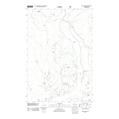
2011 Map of Rose Springs
USGS Topo · Published 2011About this map
Rose Springs serves as the focal point for this landscape in the Blue Mountains region of Washington, where a complex network of springs and drainage systems defines the geography. The area is marked by numerous named water sources, including Lanzie Spring, Ruchert Spring, Oliphant Spring, and Government Spring, which historically supported early mountain travel and settlement. High points like Tatman Mountain and Calloway Hill overlook deep incisions like Arbothknott Canyon, while long ridges such as Abels Ridge and Stevens Ridge provided natural routes for early forest roads. The presence of Sawmill Spring and the Alder Thicket Campground suggests a legacy of both natural resource extraction and early mountain recreation. This survey records the persistent reliance on these isolated springs in an otherwise arid upland environment, connecting the modern road system to the region's pioneering past.
Find a feature on this map
42 named features on this map. Tap any name to fly to it.
Don’t see what you’re looking for? This feature index may not catch every label — zoom into the map to look around manually.
Map Details
Editions of this 2011 Rose Springs Map
This is the sole edition of this map. No revisions or reprints were ever made.
Other maps of this area

1937 · Pomeroy
USGS Topo · 1:96,000

1942 · Pomeroy
USGS Topo · 1:125,000

1943 · Peola
USGS Topo · 1:62,500

1943 · Saddle Butte
USGS Topo · 1:62,500

1946 · Saddle Butte
USGS Topo · 1:62,500

1946 · Peola
USGS Topo · 1:62,500

1955 · Pullman
USGS Topo · 1:250,000

1958 · Pullman
USGS Topo · 1:250,000

1967 · Rose Springs
USGS Topo · 1:24,000

1967 · Hopkins Ridge
USGS Topo · 1:24,000