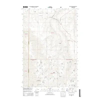
2013 Map of Rose Springs
USGS Topo · Published 2013About this map
Rose Springs sits at the heart of this landscape in the southeastern corner of Washington, where the high ridges of the Umatilla National Forest meet the deep drainages of the Blue Mountains. The terrain is defined by a series of prominent rises including Tatman Mtn, Scoggin Ridge, and Stevens Ridge, which separate deep cuts like Arbothknott Canyon. A network of remote Forest Service roads, such as Nat For Dev Rd 080 and Ruchert Rd, provides access to numerous named water sources that were essential for early grazing and settlement. These include Lanzie Spring, Ruchert Spring, Sawmill Spring, and Alder Thicket Spring. The eastern portion of the map includes the protected Pataha Research Natural Area, while the northern section transitions into the open plateau country near Calloway Hill and Tatman Gulch, reflecting the region's long-standing reliance on the complex topography for water and timber.
Find a feature on this map
50 named features on this map. Tap any name to fly to it.
Don’t see what you’re looking for? This feature index may not catch every label — zoom into the map to look around manually.
Map Details
Editions of this 2013 Rose Springs Map
This is the sole edition of this map. No revisions or reprints were ever made.
Other maps of this area

1937 · Pomeroy
USGS Topo · 1:96,000

1942 · Pomeroy
USGS Topo · 1:125,000

1943 · Peola
USGS Topo · 1:62,500

1943 · Saddle Butte
USGS Topo · 1:62,500

1946 · Saddle Butte
USGS Topo · 1:62,500

1946 · Peola
USGS Topo · 1:62,500

1955 · Pullman
USGS Topo · 1:250,000

1958 · Pullman
USGS Topo · 1:250,000

1967 · Rose Springs
USGS Topo · 1:24,000

1967 · Hopkins Ridge
USGS Topo · 1:24,000