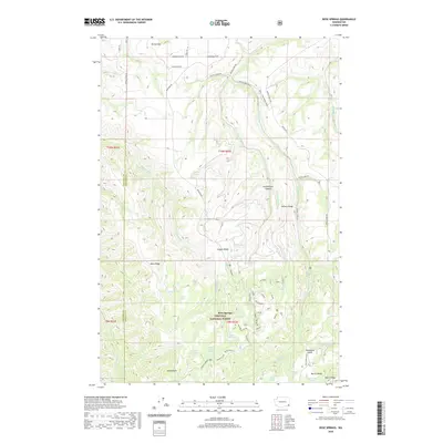
2020 Map of Rose Springs
USGS Topo · Published 2020About this map
Umatilla National Forest encompasses the southern half of this landscape, where a high concentration of water sources defines the local geography. Numerous named springs, including Rose Spring, Government Spring, Oliphant Spring, and Lanzie Spring, suggest a history of vital water access for both wildlife and early travelers through these uplands. This network of springs is situated among prominent relief features such as Abels Point and Scoggin Ridge, which separate the various drainages of Pataha Creek and Cummings Creek.
Find a feature on this map
59 named features on this map. Tap any name to fly to it.
Don’t see what you’re looking for? This feature index may not catch every label — zoom into the map to look around manually.
Map Details
Editions of this 2020 Rose Springs Map
This is the sole edition of this map. No revisions or reprints were ever made.
Other maps of this area

1937 · Pomeroy
USGS Topo · 1:96,000

1942 · Pomeroy
USGS Topo · 1:125,000

1943 · Peola
USGS Topo · 1:62,500

1943 · Saddle Butte
USGS Topo · 1:62,500

1946 · Saddle Butte
USGS Topo · 1:62,500

1946 · Peola
USGS Topo · 1:62,500

1955 · Pullman
USGS Topo · 1:250,000

1958 · Pullman
USGS Topo · 1:250,000

1967 · Rose Springs
USGS Topo · 1:24,000

1967 · Hopkins Ridge
USGS Topo · 1:24,000