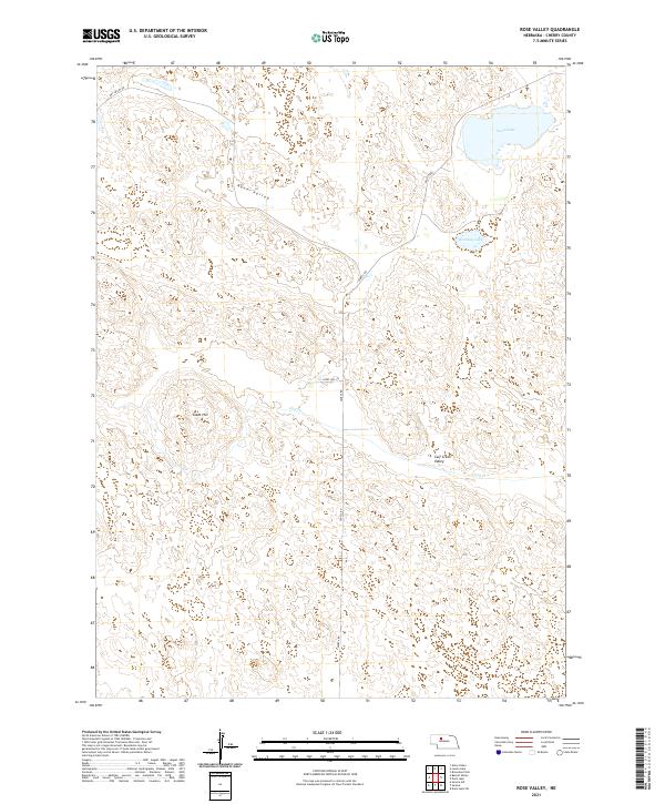
2021 Map of Rose Valley
USGS Topo · Published 2021About this map
Rose Valley defines this portion of the Nebraska Sandhills, where the landscape is marked by the distinctive hydrology and topography of Cherry County. The map details the drainage of Calf Cr as it winds through Calf Creek Valley, alongside significant water bodies like Swan Lake and Conway Lake in the northeastern quadrant. Modern infrastructure is sparse, characterized primarily by Seneca Rd and Dry Valley Rd, which navigate the undulating terrain. A prominent landmark, Giant Hill, rises above the surrounding area, with Giant Hill Ln providing access to its vicinity. This survey illustrates the relationship between the natural basin formations and the limited road network that serves these remote ranchlands.
Find a feature on this map
13 named features on this map. Tap any name to fly to it.
Don’t see what you’re looking for? This feature index may not catch every label — zoom into the map to look around manually.
Map Details
Editions of this 2021 Rose Valley Map
This is the sole edition of this map. No revisions or reprints were ever made.
Other maps of this area

1948 · Seneca
USGS Topo · 1:62,500

1948 · Seneca 4
USGS Topo · 1:62,500

1949 · Seneca 4
USGS Topo · 1:62,500

1951 · Seneca
USGS Topo · 1:62,500

1951 · Bull Lake
USGS Topo · 1:62,500

1951 · Brownlee
USGS Topo · 1:62,500

1957 · Valentine
USGS Topo · 1:250,000

1959 · Valentine
USGS Topo · 1:250,000

1985 · Goose Creek
USGS Topo · 1:100,000
1985 · Brownlee Flats
USGS Topo · 1:24,000