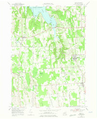
1953 Map of Rose
USGS Topo · Published 1975About this map
Sodus Bay dominates the northern reaches of this Wayne County landscape, where the southern shore of Lake Ontario meets a complex network of inlets and points including Thornton Point and Nicholas Pt. The mid-century agricultural character of the region is evident in the scattered hamlets of North Rose, South Sodus, and Wayne Center, all connected by a grid of rural roads like Brick Church Rd and Lime Kiln Rd. The New York Central railroad cuts through the terrain, serving the local economy near Alton and Glenmark. To the south, the expansive Huckleberry Swamp and the drainage of Black Brook illustrate the low-lying, marshy pockets that shaped local development and land use. Genealogists can find specific burial grounds such as Rose Cem and Barton Cem, alongside local landmarks like the Brick Church and a Pumping Sta.
Find a feature on this map
55 named features on this map. Tap any name to fly to it.
Don’t see what you’re looking for? This feature index may not catch every label — zoom into the map to look around manually.
Map Details
Editions of this 1953 Rose Map
4 editions found
Other maps of this area

1899 · Palmyra
USGS Topo · 1:62,500

1902 · Sodus Bay
USGS Topo · 1:62,500

1902 · Pultneyville
USGS Topo · 1:62,500

1902 · Clyde
USGS Topo · 1:62,500

1902 · Palmyra
USGS Topo · 1:62,500

1943 · Lyons
USGS Topo · 1:31,680

1943 · Sodus Point
USGS Topo · 1:31,680

1943 · Savannah
USGS Topo · 1:31,680

1943 · Sodus
USGS Topo · 1:31,680

1943 · Wolcott
USGS Topo · 1:31,680