
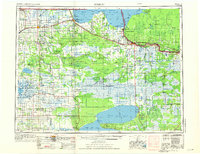
1954 Map of Roseau
USGS Topo · Published 1969About this map
Lake of the Woods dominates the northern landscape of this survey, where the international boundary between the United States and Canada follows the winding course of the Rainy River. The region transitions from the expansive waters of Big Traverse Bay and isolated points like Elm Point and Oak Point into the dense muskeg and wetlands of the Agassiz National Wildlife Refuge. Transportation in the mid-1950s was anchored by the Great Northern and Canadian National railroads, which connected timber and agricultural hubs such as Roseau, Warroad, and Baudette.
Find a feature on this map
107 named features on this map. Tap any name to fly to it.
Don’t see what you’re looking for? This feature index may not catch every label — zoom into the map to look around manually.
Map Details
Editions of this 1954 Roseau Map
2 editions found
Other maps of this area

1918 · Goos
USGS Topo · 1:62,500

1918 · Buffalo Bay
USGS Topo · 1:62,500

1918 · Winterroad
USGS Topo · 1:62,500

1918 · Roosevelt
USGS Topo · 1:62,500

1918 · Rollis
USGS Topo · 1:62,500

1918 · F
USGS Topo · 1:62,500

1918 · Williams
USGS Topo · 1:62,500

1918 · Pencer
USGS Topo · 1:62,500

1918 · Terrebonne
USGS Topo · 1:62,500

1918 · Roseau
USGS Topo · 1:62,500