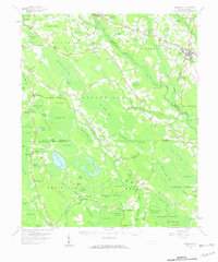
1959 Map of Roseboro
USGS Topo · Published 1960About this map
The Little Coharie Creek and South River systems define the landscape of this 1959 survey, where the Atlantic Coast Line railroad facilitates a local economy built around small settlements and clay extraction. The town of Roseboro stands as the primary hub, supported by smaller locales such as Autryville, Hayne, and Ammon. This era reveals a reliance on local industries, evidenced by several claypits and Brickkilns near the rail lines.
Find a feature on this map
123 named features on this map. Tap any name to fly to it.
Don’t see what you’re looking for? This feature index may not catch every label — zoom into the map to look around manually.
Map Details
Editions of this 1959 Roseboro Map
2 editions found

Other maps of this area

1909 · Coharie
USGS Topo · 1:62,500

1948 · Fayetteville
USGS Topo · 1:62,500

1949 · Vander
USGS Topo · 1:24,000

1953 · Florence
USGS Topo · 1:250,000

1953 · Raleigh
USGS Topo · 1:250,000

1954 · Florence
USGS Topo · 1:250,000

1954 · Raleigh
USGS Topo · 1:250,000

1954 · White Lake
USGS Topo · 1:62,500

1955 · Elizabethtown
USGS Topo · 1:62,500

1957 · Bladenboro
USGS Topo · 1:62,500