
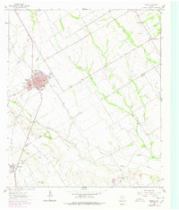
1962 Map of Rosebud
USGS Topo · Published 1964About this map
The Southern Pacific railroad corridor anchors the landscape of southern Falls County, connecting the primary settlement of Rosebud with outlying rural communities during the early 1960s. This survey illustrates the town's concentration of social and civic infrastructure, including Panther Field, American Legion Park, and Wilson White High Sch. Outside the developed street grid of Rosebud, the terrain is defined by the winding course of Big Briary Creek and Hog Creek, which flow toward the Falls Co Milam Co boundary. Genealogists will find significant value in the distribution of family and parish landmarks, such as Powers Chapel and Powers Cem in the northeast, and the cluster of Burlington Cem, St Michaels Cem, and St Luke Cem near the town of Burlington. The map reveals a transition from the structured blocks of the town center to a landscape of dispersed farms and small rural settlements like Wilderville and New Clarkson.
Find a feature on this map
30 named features on this map. Tap any name to fly to it.
Don’t see what you’re looking for? This feature index may not catch every label — zoom into the map to look around manually.
Map Details
Editions of this 1962 Rosebud Map
2 editions found
Other maps of this area

1885 · Taylor
USGS Topo · 1:125,000

1887 · Taylor
USGS Topo · 1:125,000

1892 · Temple
USGS Topo · 1:125,000

1894 · Taylor
USGS Topo · 1:125,000

1954 · Waco
USGS Topo · 1:250,000

1954 · Austin
USGS Topo · 1:250,000

1955 · Waco
USGS Topo · 1:250,000

1961 · Baileyville
USGS Topo · 1:24,000

1962 · Maysfield
USGS Topo · 1:24,000

1962 · Reagan
USGS Topo · 1:24,000