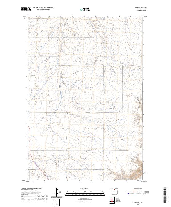
2023 Map of Rosebush
USGS Topo · Published 2023About this map
Rutledge serves as the central focal point of this Sherman County landscape, situated amid a complex network of canyons and drainages. The area is defined by its seasonal and perennial water sources, including the namesake Rosebush Creek, Draw Creek, and Finnegan Creek which flows toward the southwest corner. Local land management and ranching history are evident in the naming of features such as Borstel Pond and the network of primitive roads like Von Borstel Rd and Smith Todd Rd.
Find a feature on this map
32 named features on this map. Tap any name to fly to it.
Don’t see what you’re looking for? This feature index may not catch every label — zoom into the map to look around manually.
Map Details
Editions of this 2023 Rosebush Map
This is the sole edition of this map. No revisions or reprints were ever made.
Other maps of this area

1953 · The Dalles
USGS Topo · 1:250,000

1956 · The Dalles
USGS Topo · 1:250,000

1957 · The Dalles
USGS Topo · 1:250,000

1962 · Erskine
USGS Topo · 1:24,000

1962 · Grass Valley
USGS Topo · 1:24,000

1970 · Indian Cove
USGS Topo · 1:24,000

1970 · Kent
USGS Topo · 1:24,000

1970 · Rosebush
USGS Topo · 1:24,000

1971 · Moro
USGS Topo · 1:24,000
1971 · Horseshoe Bend
USGS Topo · 1:24,000