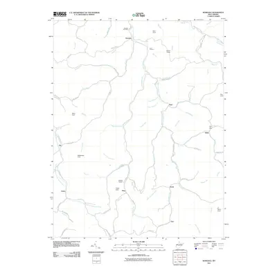
2011 Map of Rosedale
USGS Topo · Published 2011About this map
Rosedale and its namesake post office anchor the northern reaches of this rural West Virginia landscape, where the Right Fork Steer Creek carves a path through high ridges and deep hollows. The settlement pattern follows the intricate drainage system of the Little Kanawha River basin, connecting small communities like Tague, Wilsie, and Dessie via winding valley roads such as Rosedale Rd. Historical points of interest include the Bourn Cemetery and the Wilsie Post Office, markers of a long-standing rural social fabric.
Find a feature on this map
81 named features on this map. Tap any name to fly to it.
Don’t see what you’re looking for? This feature index may not catch every label — zoom into the map to look around manually.
Map Details
Editions of this 2011 Rosedale Map
This is the sole edition of this map. No revisions or reprints were ever made.
Other maps of this area

1893 · Sutton
USGS Topo · 1:125,000

1906 · Glenville
USGS Topo · 1:62,500

1906 · Otter
USGS Topo · 1:62,500

1907 · Otter
USGS Topo · 1:62,500

1907 · Arnoldsburg
USGS Topo · 1:62,500

1908 · Gassaway
USGS Topo · 1:48,000

1910 · Gassaway
USGS Topo · 1:62,500

1925 · Glenville
USGS Topo · 1:62,500

1925 · Arnoldsburg
USGS Topo · 1:62,500

1927 · Arnoldsburg
USGS Topo · 1:62,500