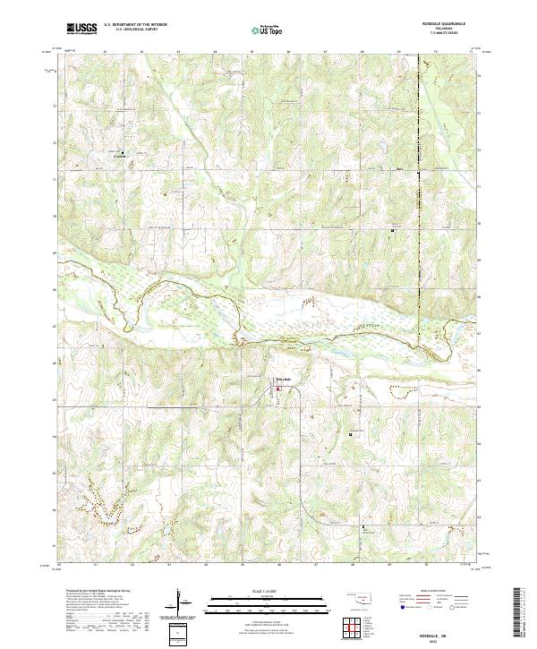
2022 Map of Rosedale
USGS Topo · Published 2022About this map
The Canadian River serves as a prominent geographic boundary in this central Oklahoma landscape, where the borders of McClain, Cleveland, and Pottawatomie counties converge. The small settlement of Rosedale is the primary hub of the southern portion of the map, centered around Main St and Chickasaw Ave. To the north lies Corbett, a community defined by its proximity to several local tributaries including Buckhead Cr.
Find a feature on this map
55 named features on this map. Tap any name to fly to it.
Don’t see what you’re looking for? This feature index may not catch every label — zoom into the map to look around manually.
Map Details
Editions of this 2022 Rosedale Map
This is the sole edition of this map. No revisions or reprints were ever made.
Other maps of this area

1893 · Norman
USGS Topo · 1:62,500

1898 · Purcell
USGS Topo · 1:125,000

1898 · Pauls Valley
USGS Topo · 1:125,000

1902 · Pauls Valley
USGS Topo · 1:125,000

1910 · McComb
USGS Topo · 1:62,500

1936 · Norman
USGS Topo · 1:62,500

1954 · Oklahoma City
USGS Topo · 1:250,000

1957 · Ardmore
USGS Topo · 1:250,000

1957 · Oklahoma City
USGS Topo · 1:250,000
1958 · Tribbey
USGS Topo · 1:24,000