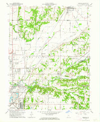
1962 Map of Rosedale
USGS Topo · Published 1964About this map
Otter Creek meanders through this landscape on the border of Parke Co and Vigo Co, serving as a focal point for a dense network of early 1960s transportation and infrastructure. The rail-heavy corridor is defined by the Pennsylvania, Baltimore and Ohio, and Chicago and Eastern Illinois railroads, which converge near settlements like Rosedale and Otter Creek Junction. These tracks facilitated local industry, evidenced by the Strip Mine and various gravel pits near North Terre Haute.
Find a feature on this map
70 named features on this map. Tap any name to fly to it.
Don’t see what you’re looking for? This feature index may not catch every label — zoom into the map to look around manually.
Map Details
Editions of this 1962 Rosedale Map
Other maps of this area

1908 · Clay City
USGS Topo · 1:48,000

1910 · Clay City
USGS Topo · 1:62,500

1941 · Seelyville
USGS Topo · 1:24,000

1941 · Terre Haute
USGS Topo · 1:24,000

1948 · Terre Haute
USGS Topo · 1:24,000

1950 · Rosedale
USGS Topo · 1:24,000

1950 · Brazil West
USGS Topo · 1:24,000

1950 · New Goshen
USGS Topo · 1:24,000

1951 · Clinton
USGS Topo · 1:24,000

1951 · Mecca
USGS Topo · 1:24,000