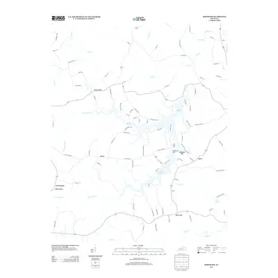
2013 Map of Rosewood
USGS Topo · Published 2013About this map
Lake Malone branches through the landscape, creating a complex system of coves and inlets like Whiskey Bay and Whiterock Cliff. The settlement patterns in this part of Todd County reflect a history of rural crossroads and community nodes, anchored by places with distinctive names such as Tyewhoppety and Mays Store. The map reveals a dense network of local roads and family-named lanes, including Carver Hankins Ln and Jonah Wilson Rd, which connect the small hamlets of Rosewood, Jason, and Agnes. In the southern reaches, Deer Lick sits near the winding path of Clifty Cr, while the Diamond Springs cemetery provides a primary point of interest for genealogists tracing regional family history. The drainage of Sulphur Spring Cr and Pryor Cr further defines the topography of this Kentucky countryside.
Find a feature on this map
92 named features on this map. Tap any name to fly to it.
Don’t see what you’re looking for? This feature index may not catch every label — zoom into the map to look around manually.
Map Details
Editions of this 2013 Rosewood Map
This is the sole edition of this map. No revisions or reprints were ever made.
Other maps of this area

1911 · Drakesboro
USGS Topo · 1:48,000

1911 · Dunmor
USGS Topo · 1:48,000

1913 · Drakesboro
USGS Topo · 1:62,500

1914 · Dunmor
USGS Topo · 1:62,500

1951 · Lewisburg
USGS Topo · 1:24,000

1952 · Sharon Grove
USGS Topo · 1:24,000

1952 · Allegre
USGS Topo · 1:24,000

1952 · Greenville
USGS Topo · 1:24,000

1953 · Drakesboro
USGS Topo · 1:24,000

1953 · Rosewood
USGS Topo · 1:24,000