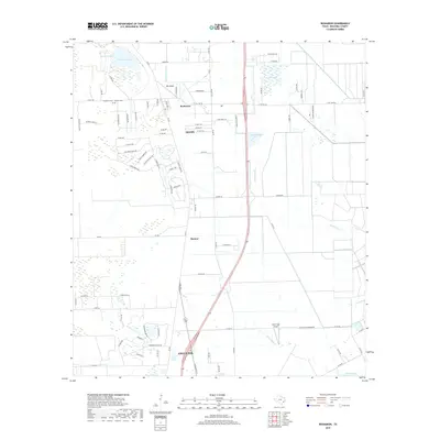
2019 Map of Rosharon
USGS Topo · Published 2019About this map
Rosharon and the neighboring settlements of Bonney and Alvin occupy this coastal prairie landscape in Brazoria County, characterized by a complex network of bayous and drainage laterals. The terrain is defined by the winding courses of Austin Bayou and Flores Bayou, which cut through a grid of county roads and expanding residential developments. To the north, Thurmond Lake and Bonner Slough provide significant hydrologic landmarks near the historical Daughters Cemetery and Pilgrim Cemetery.
Find a feature on this map
83 named features on this map. Tap any name to fly to it.
Don’t see what you’re looking for? This feature index may not catch every label — zoom into the map to look around manually.
Map Details
Editions of this 2019 Rosharon Map
This is the sole edition of this map. No revisions or reprints were ever made.
Other maps of this area

1943 · Rosharon
USGS Topo · 1:31,680

1943 · Danbury
USGS Topo · 1:31,680

1943 · Juliff
USGS Topo · 1:31,680

1943 · Angleton
USGS Topo · 1:24,000

1943 · Chocolate Bayou
USGS Topo · 1:24,000

1950 · Houston
USGS Topo · 1:250,000

1952 · East Columbia
USGS Topo · 1:24,000

1953 · Otey
USGS Topo · 1:24,000

1953 · Thompsons
USGS Topo · 1:24,000
1956 · Manvel
USGS Topo · 1:24,000