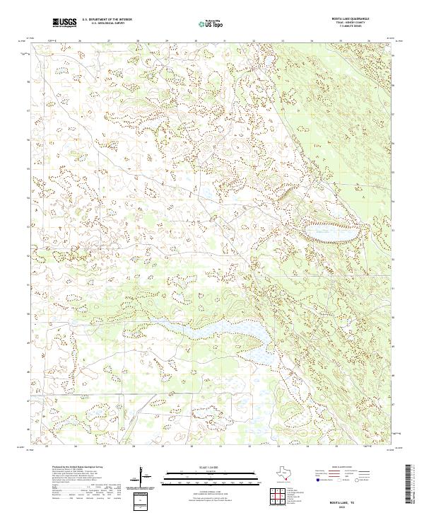
2022 Map of Rosita Lake
USGS Topo · Published 2022About this map
Rosita Lake anchors this landscape in Kenedy County, serving as a significant hydrologic feature in a region defined by scattered wetlands and intermittent water bodies. The terrain reflects the sparse, ranch-oriented character of South Texas, where the movement of people and livestock is facilitated by local arteries such as H Yturria Rd. This 2022 survey captures the modern spatial organization of the area, illustrating how historic family ranching names continue to influence the geographic nomenclature and infrastructure of the coastal plain. The lack of dense settlement emphasizes the remote, conserved nature of these large landholdings, where natural depressions and seasonal ponds dictate the layout of private roads and property boundaries.
Find a feature on this map
2 named features on this map. Tap any name to fly to it.
Don’t see what you’re looking for? This feature index may not catch every label — zoom into the map to look around manually.
Map Details
Editions of this 2022 Rosita Lake Map
This is the sole edition of this map. No revisions or reprints were ever made.
Other maps of this area

1921 · Tarida Ranch
USGS Topo · 1:62,500

1922 · La Sal Vieja
USGS Topo · 1:62,500

1923 · Armstrong
USGS Topo · 1:62,500

1923 · Saltillo Ranch
USGS Topo · 1:62,500

1953 · Brownsville
USGS Topo · 1:250,000

1956 · Saltillo Well
USGS Topo · 1:24,000

1956 · Rudolph
USGS Topo · 1:24,000
1956 · Los Amigos Windmill
USGS Topo · 1:24,000

1956 · Rosita Lake
USGS Topo · 1:24,000

1956 · San Perlita North
USGS Topo · 1:24,000