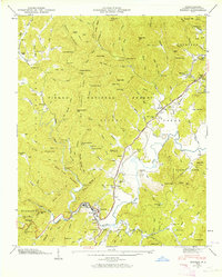
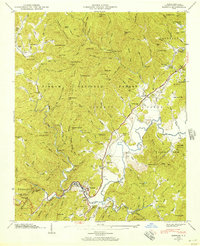
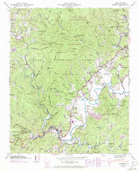
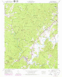
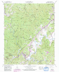
1945 Map of Rosman
USGS Topo · Published 1964About this map
The French Broad River system defines the topography of this Transylvania County landscape, where the Southern Railway follows the river valley through the town of Rosman. This mid-century survey captures a complex network of mountain gaps and ridges within the Pisgah National Forest, including Low Notch Gap and Big Mountain Gap. A notable concentration of specialized camps and institutions exists here, from the State Prison Camp near Calvert to recreational and educational sites like Camp Illahee, Keystone Camp, and the Transylvania School Camp. Genealogists may find particular value in the documentation of several family-named landmarks and resting places, such as Whitmire Cem, Gillespie Cem, and Graveyard Hill. The placement of Gaging Stations along the river and its tributaries, including Catheys Creek, reflects the region's active water management during this era.
Find a feature on this map
99 named features on this map. Tap any name to fly to it.
Don’t see what you’re looking for? This feature index may not catch every label — zoom into the map to look around manually.
Map Details
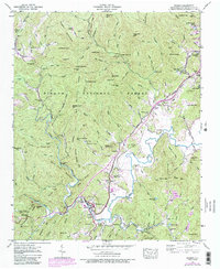
Editions of this 1945 Rosman Map
6 editions found
Other maps of this area

1905 · Pisgah
USGS Topo · 1:125,000

1906 · Pisgah
USGS Topo · 1:125,000

1935 · Brevard
USGS Topo · 1:24,000

1935 · Eastatoe Gap
USGS Topo · 1:24,000

1935 · Sam Knob
USGS Topo · 1:24,000
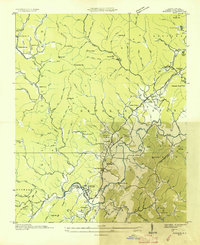
1935 · Rosman
USGS Topo · 1:24,000

1935 · Lake Toxaway
USGS Topo · 1:24,000

1935 · Reid
USGS Topo · 1:24,000

1935 · Table Rock
USGS Topo · 1:24,000

1935 · Shining Rock
USGS Topo · 1:24,000