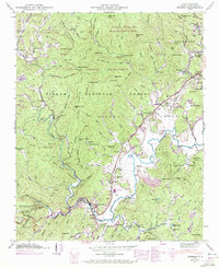
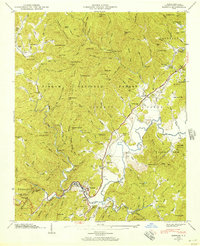
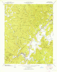
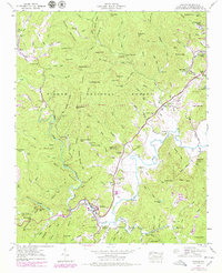
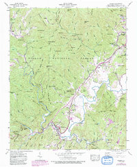
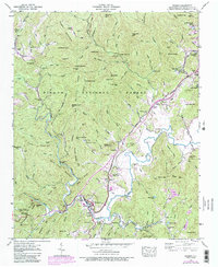
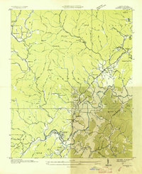
1945 Map of Rosman
USGS Topo · Published 1972About this map
The French Broad River serves as the central artery for this portion of Transylvania County, where the headwaters meet the rugged terrain of the Pisgah National Forest. The settlement of Rosman functions as a local hub, situated at the confluence where the Southern Railway lines followed the river's winding path. This mid-century view captures a transition from traditional Appalachian subsistence to modern technical infrastructure, as evidenced by the presence of the NASA Tracking Station near Balsam Grove and the State Prison Camp along the river banks.
Find a feature on this map
104 named features on this map. Tap any name to fly to it.
Don’t see what you’re looking for? This feature index may not catch every label — zoom into the map to look around manually.
Map Details
Editions of this 1945 Rosman Map
6 editions found
Other maps of this area

1905 · Pisgah
USGS Topo · 1:125,000

1906 · Pisgah
USGS Topo · 1:125,000

1935 · Brevard
USGS Topo · 1:24,000

1935 · Eastatoe Gap
USGS Topo · 1:24,000

1935 · Sam Knob
USGS Topo · 1:24,000
1935 · Rosman
USGS Topo · 1:24,000

1935 · Lake Toxaway
USGS Topo · 1:24,000

1935 · Reid
USGS Topo · 1:24,000

1935 · Table Rock
USGS Topo · 1:24,000

1935 · Shining Rock
USGS Topo · 1:24,000