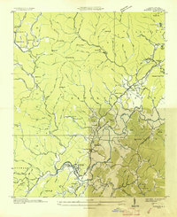
1945 Map of Rosman
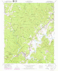
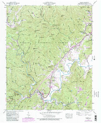
USGS Topo · Published 1991About this map
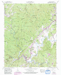
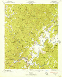
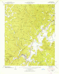
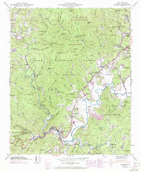
Rosman sits at the confluence of the French Broad river forks, serving as a hub for timber and mountain travel during the mid-twentieth century. This survey, updated with late 1980s aerial revisions, illustrates the deep integration of recreational and institutional sites within the Pisgah National Forest. The landscape is dotted with established summer retreats like Keystone Camp, Camp Illahee, and Camp Cherryfield, alongside more unexpected local landmarks including a drive-in theater and the NASA Tracking Station.
Find a feature on this map
116 named features on this map. Tap any name to fly to it.
Don’t see what you’re looking for? This feature index may not catch every label — zoom into the map to look around manually.
Map Details
Editions of this 1945 Rosman Map
6 editions found
Other maps of this area

1905 · Pisgah
USGS Topo · 1:125,000

1906 · Pisgah
USGS Topo · 1:125,000

1935 · Brevard
USGS Topo · 1:24,000

1935 · Eastatoe Gap
USGS Topo · 1:24,000

1935 · Sam Knob
USGS Topo · 1:24,000
1935 · Rosman
USGS Topo · 1:24,000

1935 · Lake Toxaway
USGS Topo · 1:24,000

1935 · Reid
USGS Topo · 1:24,000

1935 · Table Rock
USGS Topo · 1:24,000

1935 · Shining Rock
USGS Topo · 1:24,000