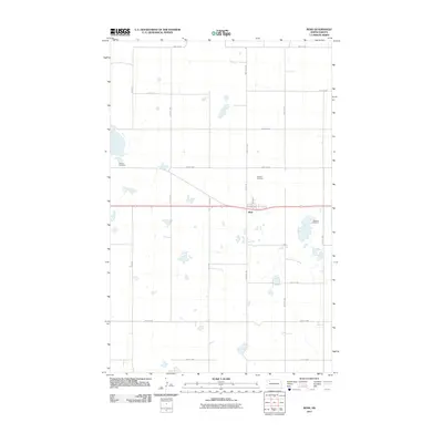
2011 Map of Ross
USGS Topo · Published 2011About this map
Ross occupies a central position on this Mountrail County landscape, where the rectilinear grid of local section roads converges at the town site. The map captures the area's rural character through a series of scattered water bodies and a notable concentration of three distinct burial grounds. Genealogists and local historians can locate Manitou Cemetery to the west, while Rosehill Cemetery and the Moslem Cemetery serve the community to the east. The local transportation network is defined by the intersection of Main St and Central Ave, branching out into a expansive grid of routes such as 92nd Ave and 66th St NW that navigate the prairie potholes and marshy terrain characteristic of this part of North Dakota.
Find a feature on this map
19 named features on this map. Tap any name to fly to it.
Don’t see what you’re looking for? This feature index may not catch every label — zoom into the map to look around manually.
Map Details
Editions of this 2011 Ross Map
This is the sole edition of this map. No revisions or reprints were ever made.
Other maps of this area

1953 · Williston
USGS Topo · 1:250,000

1957 · Williston
USGS Topo · 1:250,000

1969 · Ross NW
USGS Topo · 1:24,000

1969 · Stanley
USGS Topo · 1:24,000

1981 · Robinson Lake
USGS Topo · 1:24,000

1981 · Ross
USGS Topo · 1:24,000

1981 · Manitou
USGS Topo · 1:24,000

1981 · Lostwood
USGS Topo · 1:24,000
1981 · Rat Lake
USGS Topo · 1:24,000
1981 · Cottonwood Lake
USGS Topo · 1:24,000