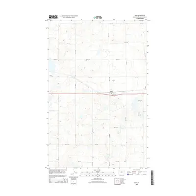
2014 Map of Ross
USGS Topo · Published 2014About this map
Ross centers this Mountrail County landscape, where the intersection of Central Ave and the railroad corridor defines the town's small-town grid. The surrounding prairie is surveyed into a precise section-line network of roads, including Cr-2 and numerous numeric routes such as 90th Ave NW and 60th St NW. Three distinct burial grounds speak to the local heritage of this rural community: Manitou Cem to the west, Rosehill Cem north of the town center, and Moslem Cem to the east. The terrain is marked by the complex, small-scale depressions and potholes typical of North Dakota's glacial drift plain, which created the scattered wetlands and irregular contours that dictate the path of local travel between established farmsteads and the central settlement.
Find a feature on this map
21 named features on this map. Tap any name to fly to it.
Don’t see what you’re looking for? This feature index may not catch every label — zoom into the map to look around manually.
Map Details
Editions of this 2014 Ross Map
This is the sole edition of this map. No revisions or reprints were ever made.
Other maps of this area

1953 · Williston
USGS Topo · 1:250,000

1957 · Williston
USGS Topo · 1:250,000

1969 · Ross NW
USGS Topo · 1:24,000

1969 · Stanley
USGS Topo · 1:24,000

1981 · Robinson Lake
USGS Topo · 1:24,000

1981 · Ross
USGS Topo · 1:24,000

1981 · Manitou
USGS Topo · 1:24,000

1981 · Lostwood
USGS Topo · 1:24,000
1981 · Rat Lake
USGS Topo · 1:24,000
1981 · Cottonwood Lake
USGS Topo · 1:24,000