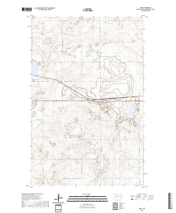
2024 Map of Ross
USGS Topo · Published 2024About this map
Ross stands as a focal point in this northwestern North Dakota landscape, situated along a transportation corridor defined by Co Hwy 2 and a network of section-line roads. The area is notable for its numerous small wetlands and prairie potholes, many of which are protected within the Mountrail County Waterfowl Production Area. These natural features dominate the township divisions, including t156n r92w and t155n r93w, illustrating the glaciated terrain of the Missouri Plateau. Genealogical interest is particularly high here due to the presence of three distinct burial sites: Manitou Cem to the west, Rosehill Cem near the town center, and the Moslem Cem to the east, reflecting the diverse cultural and religious history of the early homesteading era in Mountrail County.
Find a feature on this map
28 named features on this map. Tap any name to fly to it.
Don’t see what you’re looking for? This feature index may not catch every label — zoom into the map to look around manually.
Map Details
Editions of this 2024 Ross Map
This is the sole edition of this map. No revisions or reprints were ever made.
Other maps of this area

1953 · Williston
USGS Topo · 1:250,000

1957 · Williston
USGS Topo · 1:250,000

1969 · Ross NW
USGS Topo · 1:24,000

1969 · Stanley
USGS Topo · 1:24,000

1981 · Robinson Lake
USGS Topo · 1:24,000

1981 · Ross
USGS Topo · 1:24,000

1981 · Manitou
USGS Topo · 1:24,000

1981 · Lostwood
USGS Topo · 1:24,000
1981 · Rat Lake
USGS Topo · 1:24,000
1981 · Cottonwood Lake
USGS Topo · 1:24,000