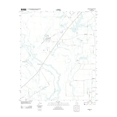
2012 Map of Rosser
USGS Topo · Published 2012About this map
Rosser stands at a bend in the Old Channel E Fork Trinity River, serving as a primary settlement in this low-lying landscape defined by complex hydrology. The map illustrates a highly managed water system where the Trinity River and its various offshoots, such as Deadman Slough and Ezell Slough, interact with modern engineering. Significant land management is evident through numerous reservoirs like Soil Conservation Service Site 1 Reservoir and specialized features such as the Hillside Diversion Terrace. This intersection of natural waterways and conservation projects shaped the local economy and settlement patterns of towns like Cottonwood and Peeltown. Genealogists can locate several burial grounds, including Rosser Cem, Cottonwood Cem, and Green Cem, which remain as permanent landmarks amid the shifting river channels and agricultural fields of the floodplain.
Find a feature on this map
67 named features on this map. Tap any name to fly to it.
Don’t see what you’re looking for? This feature index may not catch every label — zoom into the map to look around manually.
Map Details
Editions of this 2012 Rosser Map
This is the sole edition of this map. No revisions or reprints were ever made.
Other maps of this area

1891 · Dallas
USGS Topo · 1:125,000

1893 · Dallas
USGS Topo · 1:125,000

1954 · Dallas
USGS Topo · 1:250,000

1956 · Ennis
USGS Topo · 1:62,500

1956 · Kaufman
USGS Topo · 1:62,500

1958 · Dallas
USGS Topo · 1:250,000

1959 · India
USGS Topo · 1:24,000

1959 · Seagoville
USGS Topo · 1:62,500

1960 · Grays Prairie
USGS Topo · 1:24,000

1962 · Ennis East
USGS Topo · 1:24,000