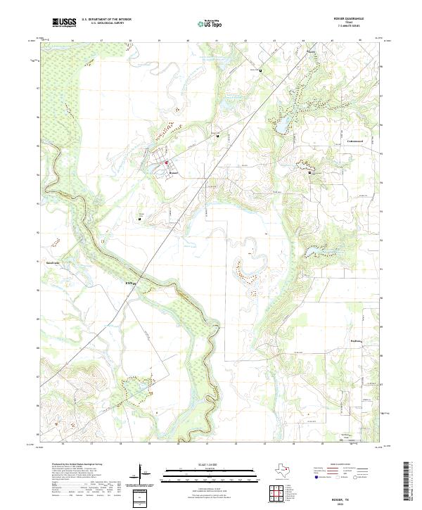
2022 Map of Rosser
USGS Topo · Published 2022About this map
The Trinity River and its meandering oxbows define the low-lying geography of this portion of Kaufman and Ellis Counties. The landscape is characterized by a complex network of sloughs and lateral water management sites, including the Old Channel E Fork Trinity River and Ezell Slough. Small agricultural communities like Rosser, Scurry, and Cottonwood are connected by a web of county roads and FM routes, with local history preserved at sites such as Rosser Cem and Cottonwood Cem. The transition from the river bottomlands to the surrounding plains is marked by distinctive water bodies like Hugghins Lake and Four Wire Lake. The presence of Tali Homma Field near the southern boundary and various soil conservation reservoirs reflects the modern land use and aviation history of this rural Texas corridor.
Find a feature on this map
61 named features on this map. Tap any name to fly to it.
Don’t see what you’re looking for? This feature index may not catch every label — zoom into the map to look around manually.
Map Details
Editions of this 2022 Rosser Map
This is the sole edition of this map. No revisions or reprints were ever made.
Other maps of this area

1891 · Dallas
USGS Topo · 1:125,000

1893 · Dallas
USGS Topo · 1:125,000

1954 · Dallas
USGS Topo · 1:250,000

1956 · Ennis
USGS Topo · 1:62,500

1956 · Kaufman
USGS Topo · 1:62,500

1958 · Dallas
USGS Topo · 1:250,000

1959 · India
USGS Topo · 1:24,000

1959 · Seagoville
USGS Topo · 1:62,500

1960 · Grays Prairie
USGS Topo · 1:24,000

1962 · Ennis East
USGS Topo · 1:24,000