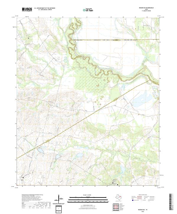
2022 Map of Rosser SW
USGS Topo · Published 2022About this map
The Trinity River winds through this landscape on the boundary of Navarro, Ellis, and Henderson counties, defining a region of riparian bottomlands and agricultural prairie. Near the settlement of Rice, the landscape is dotted with local history markers including the Rice Cem and several rural burial grounds like Hooper Cem and the Chatfield Cem Memorial Number 1. The terrain is shaped by the hydrology of numerous tributaries, including Village Cr, Walker Cr, and Cottonwood Cr, which feed into the primary river system.
Find a feature on this map
61 named features on this map. Tap any name to fly to it.
Don’t see what you’re looking for? This feature index may not catch every label — zoom into the map to look around manually.
Map Details
Editions of this 2022 Rosser SW Map
This is the sole edition of this map. No revisions or reprints were ever made.
Other maps of this area

1954 · Dallas
USGS Topo · 1:250,000

1956 · Ennis
USGS Topo · 1:62,500

1958 · Dallas
USGS Topo · 1:250,000

1960 · Grays Prairie
USGS Topo · 1:24,000

1961 · Chatfield
USGS Topo · 1:24,000

1962 · Bazette
USGS Topo · 1:24,000

1962 · Emhouse
USGS Topo · 1:24,000

1962 · Ennis East
USGS Topo · 1:24,000

1962 · Rosser SW
USGS Topo · 1:24,000
1962 · Styx
USGS Topo · 1:24,000