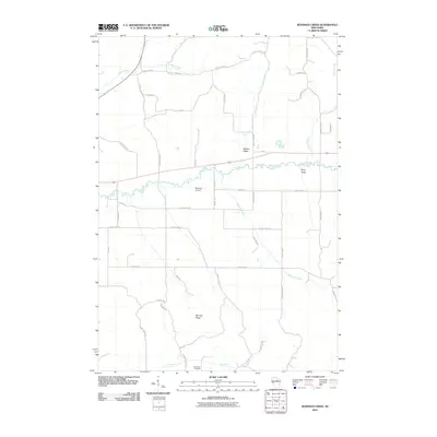
2010 Map of Rossman Creek
USGS Topo · Published 2010About this map
The meandering Buffalo River carves a deep valley through this agricultural landscape, creating a distinct topographical boundary between the northern plateaus and the southern ridges. Small tributaries like Peeso Creek and Lindsay Creek drain the surrounding highlands, where dairy farming and rural homesteads predominate. The map reveals a high concentration of family-named roads such as Strumness Rd, Gonty Rd, and Swiggum Rd, which reflect the generations of local families who settled this portion of Eau Claire and Buffalo Counties.
Find a feature on this map
45 named features on this map. Tap any name to fly to it.
Don’t see what you’re looking for? This feature index may not catch every label — zoom into the map to look around manually.
Map Details
Editions of this 2010 Rossman Creek Map
This is the sole edition of this map. No revisions or reprints were ever made.
Other maps of this area

1926 · Whitehall
USGS Topo · 1:62,500

1927 · Strum
USGS Topo · 1:62,500

1929 · Whitehall
USGS Topo · 1:62,500

1930 · Strum
USGS Topo · 1:62,500

1932 · Gilmanton
USGS Topo · 1:62,500

1932 · Mondovi
USGS Topo · 1:62,500

1953 · Eau Claire
USGS Topo · 1:250,000

1958 · Eau Claire
USGS Topo · 1:250,000

1964 · Eau Claire
USGS Topo · 1:250,000
1973 · Cleghorn
USGS Topo · 1:24,000