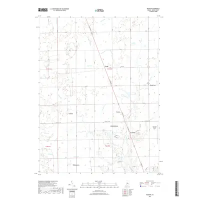
2019 Map of Rosston
USGS Topo · Published 2019About this map
N Michigan Rd serves as the central corridor through this section of Boone County, anchoring a series of small rural communities and agricultural tracts. The map illustrates a landscape shaped by drainage and topography, where Mounts Run and Eagle Cr wind through fields alongside a complex network of man-made ditches like McCoy Ditch and Campbell Ditch. Settlement patterns here range from the more established streets of Zionsville and Whitestown in the south to smaller, quieter crossroads like Waugh and Big Springs further north. Cultural history is preserved at sites such as Bethel Cem and Jones Cem, while the modern utility of the land is evident in the sprawling layout of the Indianapolis Executive Airport near Northfield. This survey documents the persistent grid of county roads, such as W Base Line Rd, which maintains the traditional section-line boundaries of the township system.
Find a feature on this map
79 named features on this map. Tap any name to fly to it.
Don’t see what you’re looking for? This feature index may not catch every label — zoom into the map to look around manually.
Map Details
Editions of this 2019 Rosston Map
This is the sole edition of this map. No revisions or reprints were ever made.
Other maps of this area

1952 · Carmel
USGS Topo · 1:24,000

1953 · Westfield
USGS Topo · 1:24,000

1953 · Fayette
USGS Topo · 1:24,000

1953 · Rosston
USGS Topo · 1:24,000

1953 · Zionsville
USGS Topo · 1:24,000

1953 · Lebanon
USGS Topo · 1:24,000

1953 · Danville
USGS Topo · 1:250,000

1953 · Indianapolis
USGS Topo · 1:250,000

1955 · Danville
USGS Topo · 1:250,000

1956 · Danville
USGS Topo · 1:250,000